


Avondale Public Library, Jefferson County, Alabama
About
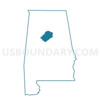
Outline

Summary
| Unique Area Identifier | 522012 |
| Name | Avondale Public Library |
| County | Jefferson County |
| State | Alabama |
| Area (square miles) | 1.17 |
| Land Area (square miles) | 1.17 |
| Water Area (square miles) | 0.00 |
| % of Land Area | 99.81 |
| % of Water Area | 0.19 |
| Latitude of the Internal Point | 33.51088080 |
| Longtitude of the Internal Point | -86.77447120 |
Maps


Graphs
Select a template below for downloading or customizing gragh for Avondale Public Library, Jefferson County, Alabama


Neighbors
Neighoring Voting District (by Name) Neighboring Voting District on the Map
- Avondale Elementary School, Jefferson County, AL
- Birmingham Botanical Gardens, Jefferson County, AL
- Birmingham Fire Station #22, Jefferson County, AL
- Crestwood Community Educational Center, Jefferson County, AL
- Morton Simpson Community Center, Jefferson County, AL
- Mountain Brook City Hall, Jefferson County, AL
- Southtown Housing Community Center, Jefferson County, AL
- Willow Wood Recreation Center, Jefferson County, AL
Top 10 Neighboring County Subdivision (by Population) Neighboring County Subdivision on the Map
Top 10 Neighboring Place (by Population) Neighboring Place on the Map
Top 10 Neighboring Unified School District (by Population) Neighboring Unified School District on the Map
- Jefferson County School District, AL (230,679)
- Birmingham City School District, AL (212,237)
- Mountain Brook City School District, AL (20,413)
Top 10 Neighboring State Legislative District Lower Chamber (by Population) Neighboring State Legislative District Lower Chamber on the Map
- State House District 46, AL (50,398)
- State House District 52, AL (43,159)
- State House District 53, AL (35,378)
- State House District 54, AL (34,905)
Top 10 Neighboring State Legislative District Upper Chamber (by Population) Neighboring State Legislative District Upper Chamber on the Map
Top 10 Neighboring 111th Congressional District (by Population) Neighboring 111th Congressional District on the Map
Top 10 Neighboring Census Tract (by Population) Neighboring Census Tract on the Map
- Census Tract 108.01, Jefferson County, AL (5,792)
- Census Tract 24, Jefferson County, AL (3,629)
- Census Tract 47.01, Jefferson County, AL (3,480)
- Census Tract 23.06, Jefferson County, AL (3,259)
- Census Tract 47.02, Jefferson County, AL (2,944)
- Census Tract 48, Jefferson County, AL (1,861)